TerraTech
KANOPUS-V
KANOPUS-V
KANOPUS-V
KANOPUS-V
KANOPUS-V
KANOPUS-V
KANOPUS-V
Dubai, UAE
Adana, Turkey
Boston, USA
Anzio, Italy
Mumbai, India
Kagoshima, Japan
Sukhum, Abkhazia
Moscow, Russia
Main characteristics
Orbit type: circular sun-synchronous
Orbit height – 510 km
Revisit time: DailyResolution 2,5 m
Acquisition capacity 1,7 mln. sq.km/daily
Orbit height – 510 km
Revisit time: DailyResolution 2,5 m
Acquisition capacity 1,7 mln. sq.km/daily
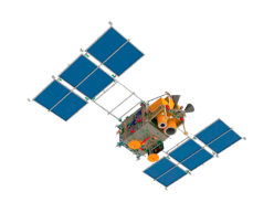


Data applications
Imagery is largely used for monitoring of environment, disasters, agriculture and forestry
Paper version
Acquisition modes
Continuous stripe scanning
Panchromatic sensor
Multispectral sensor
Multi-channel medium and far IR range sensor
Panchromatic sensor
Multispectral sensor
Multi-channel medium and far IR range sensor
Panchromatic optical system
Multispectral optical system
Multi-channel medium and far ir range radiometer


Spectral range
Terrain permit
Photo stripe width


Spectral range
Terrain permit
Photo stripe width


Spectral range
Terrain permit
Photo stripe width
Use cases
Remote sensing data is extensively used to gather intel about distant or hard to reach areas, as well as a source of objective information about places of interest. Most applications revolve around governmental control, security, disaster management, insurance, environment and investment supervision
Forest management
Agriculture
Construction
Emergencies
Mapping
Ecology
Ocean and Ice
Mining and Energy
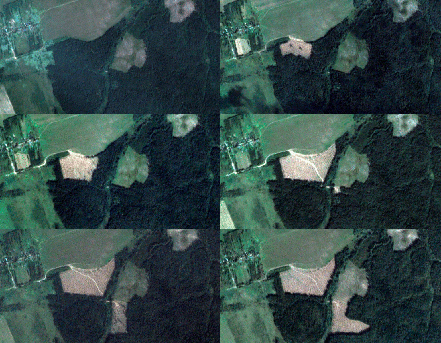
Agricultural land inventory, crop rotation and rational land use, idle lands detection
Crop conditions monitoring (biomass buildup, wetting, seedling evaluation, etc)
Identification of unauthorized occupation and damages of agricultural land
Land-use proceedings support
Crop conditions monitoring (biomass buildup, wetting, seedling evaluation, etc)
Identification of unauthorized occupation and damages of agricultural land
Land-use proceedings support
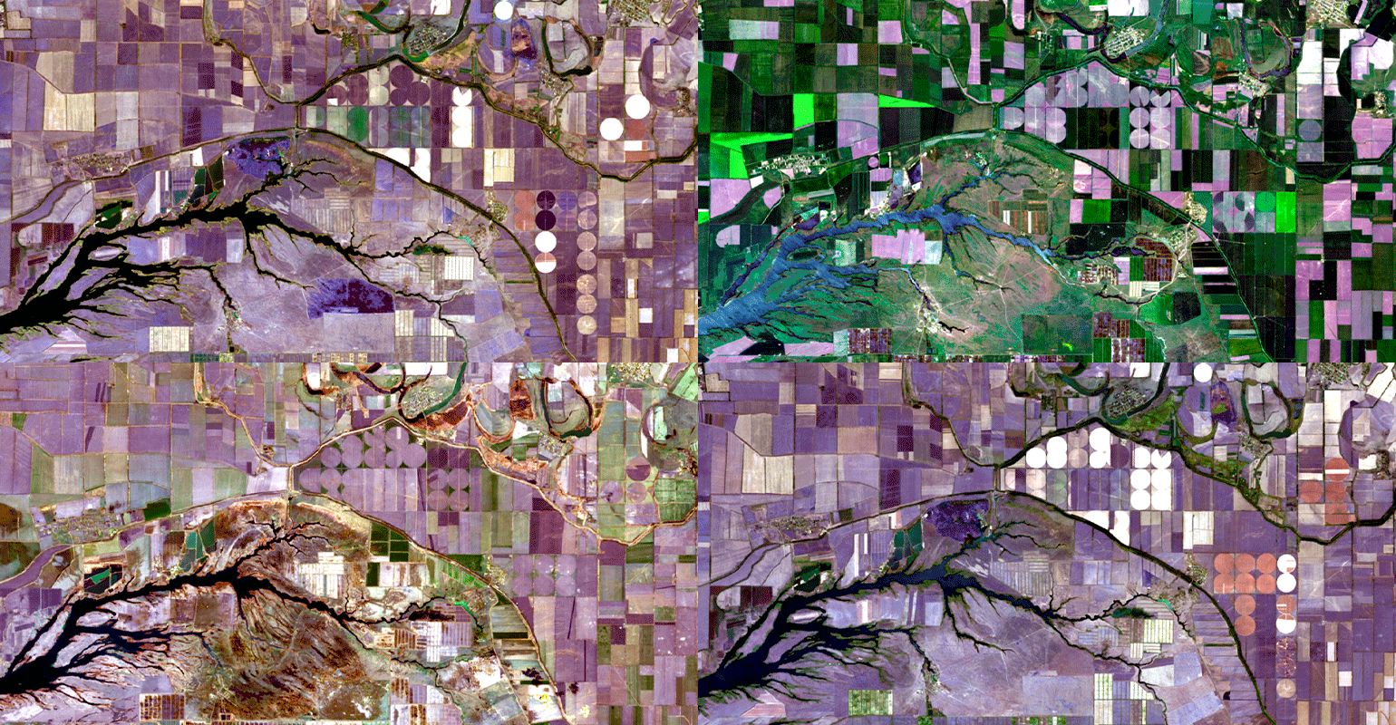
Unauthorized forest clearing detection, logging areas control and monitoring
Woodland degradation and damage identification and mapping (influence by pests and diseases, dehydration or waterlogging)
Forest ecosystem damage by disasters (active fires, burnt areas, windfalls and etc.)
Woodland degradation and damage identification and mapping (influence by pests and diseases, dehydration or waterlogging)
Forest ecosystem damage by disasters (active fires, burnt areas, windfalls and etc.)
Forest management
Agriculture
Construction
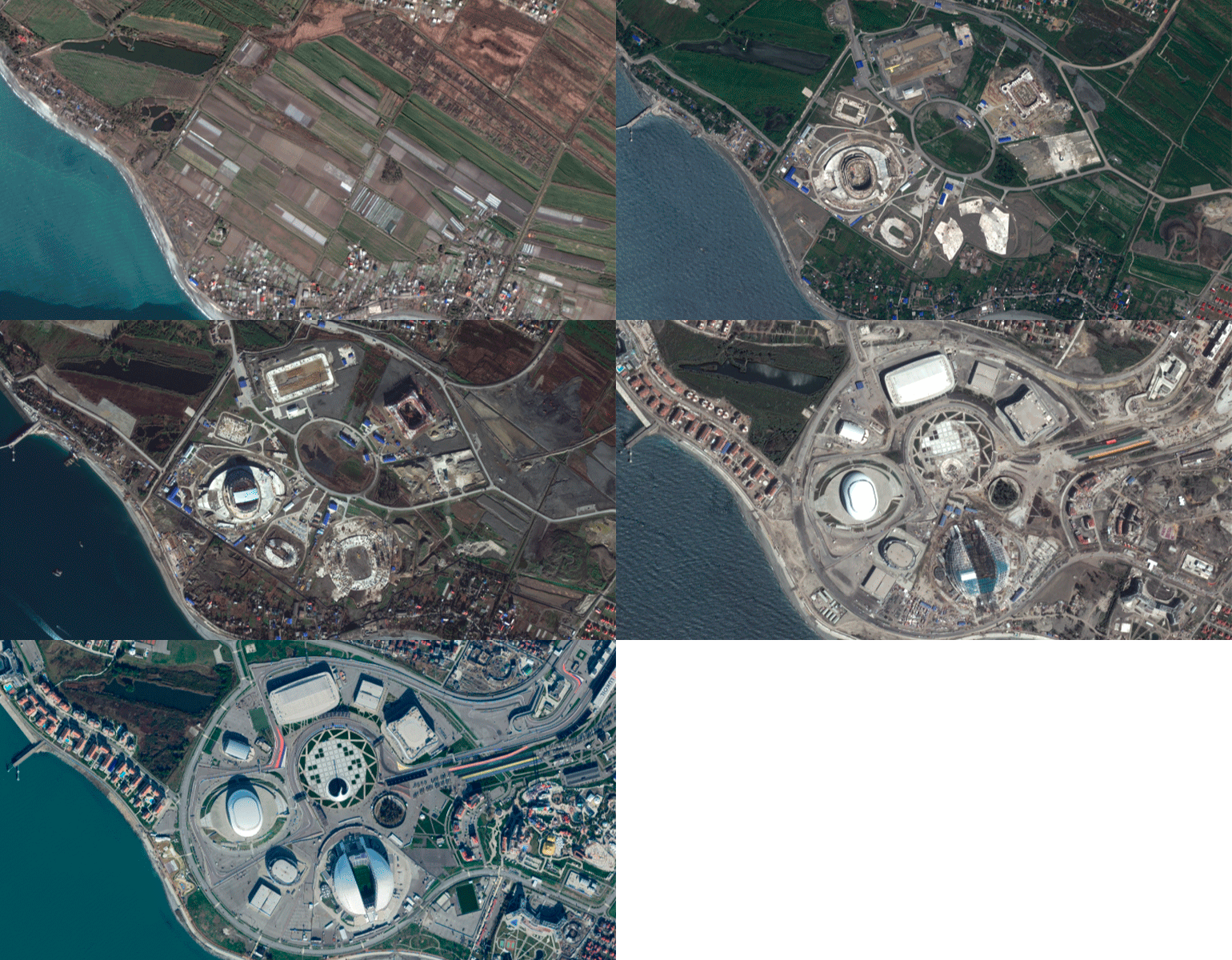
Inventory and condition assessment of existing and new assets (thematic maps etc)
Additional information support during surveys and construction planning
Monitoring of critical infrastructure conditions and integrity
Dynamic city area vegetation analysis and community landscape evaluation
Additional information support during surveys and construction planning
Monitoring of critical infrastructure conditions and integrity
Dynamic city area vegetation analysis and community landscape evaluation
Emergencies
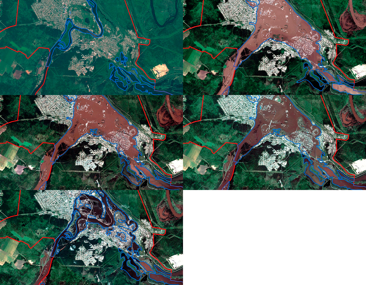
Application of Earth observation data for complex emergencies forecasting
Near-real time emergency monitoring, precise consequences mapping
Short-term forecasting and modelling of emergencies (floods, wildfires, landslides etc.)
Near-real time emergency monitoring, precise consequences mapping
Short-term forecasting and modelling of emergencies (floods, wildfires, landslides etc.)
Mapping
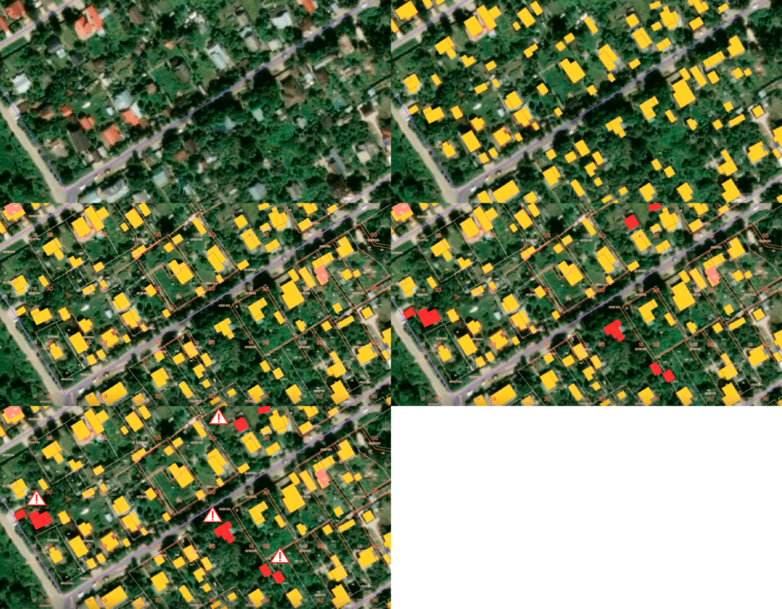
Remote sensing data is actively used to create and update maps with scale up to 1:25000
Ecology
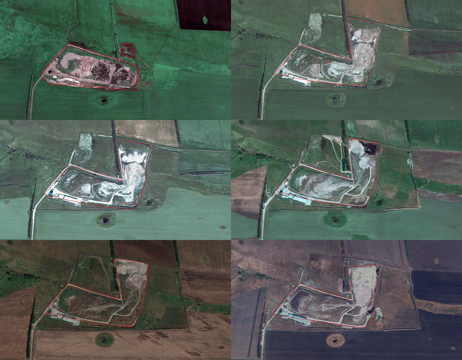
Monitor activity at operational landfills and recycling facilities
Determine landfill border violations, land and water contaminations, buffer zone breaches
Reclamation activities control and oversight
Determine landfill border violations, land and water contaminations, buffer zone breaches
Reclamation activities control and oversight
Ocean and Ice
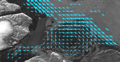
Glacier dynamics monitoring and forecasting
Sea ice charting
Ice caps melting dynamics
Snow coverage mapping
Sea ice charting
Ice caps melting dynamics
Snow coverage mapping
Mining and Energy
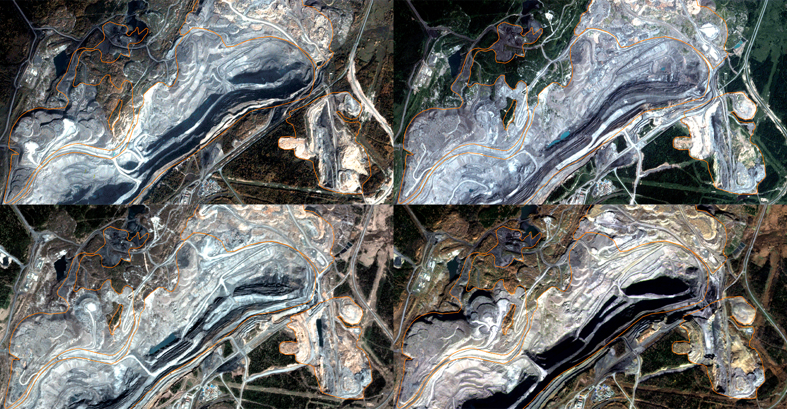
Mineral resources extraction and transportation infrastructure monitoring and mapping (surface mines, open mines, pits, trailing dumps)
Locating illegal sites of resources extraction
Ecological evaluation of extraction and production facilities
Oil spills detection at extraction points and along transportation infrastructure
Locating illegal sites of resources extraction
Ecological evaluation of extraction and production facilities
Oil spills detection at extraction points and along transportation infrastructure
RESURS-P
RESURS-P
RESURS-P
RESURS-P
RESURS-P
RESURS-P
Beirut, Lebanon
Botos, Serbia
Tripoli, Libya
Singapore
Poti, Georgia
Warsaw, Poland
Casablanca, Morocco
Gudauta, Abkhazia
Main characteristics
Orbit type: circular sun-synchronous
Orbit height – 475 km
Revisit time: 3 days
Resolution 1 m
Acquisition in tasking mode
Orbit height – 475 km
Revisit time: 3 days
Resolution 1 m
Acquisition in tasking mode
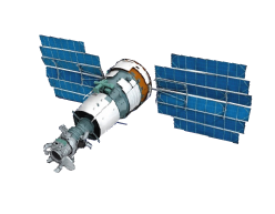


Data applications
Imagery is widely used for monitoring of environment, facilities, natural resources and disasters, mapping and more
Paper version
Acquisition modes
Single sensor acquisition
Continuous stripe scanning
All sensors simultaneous acquisition
High resolution sensor
Medium resolution sensor
Low resolution sensor
Hyperspectral sensor
Continuous stripe scanning
All sensors simultaneous acquisition
High resolution sensor
Medium resolution sensor
Low resolution sensor
Hyperspectral sensor
Spectral range
Ground sample distance
Stripe width
Stripe width
High resolution optical-electronic sensor
High resolution sensor
Medium resolution sensor
Hyperspectral sensor
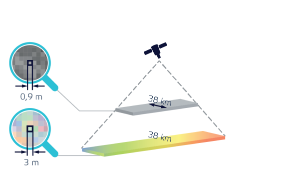
Spectral range
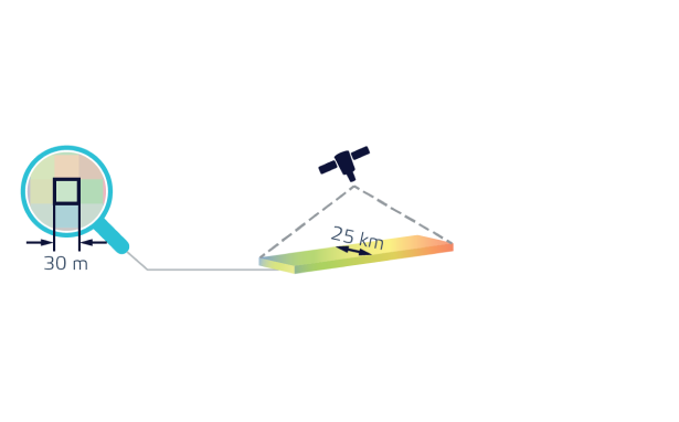
Terrain permit
Photo stripe width
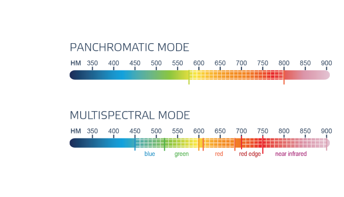
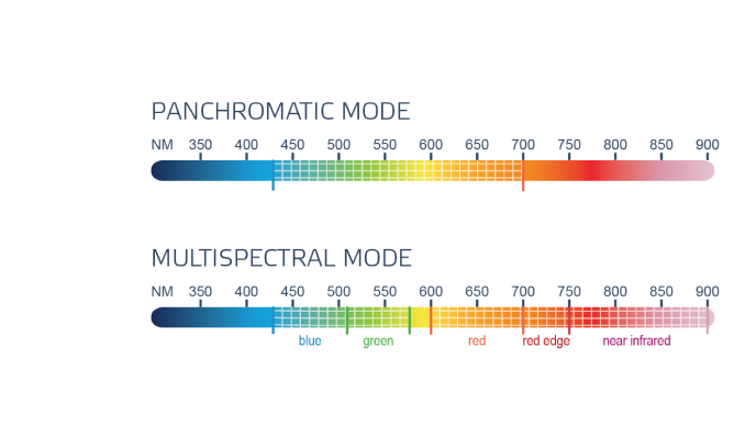
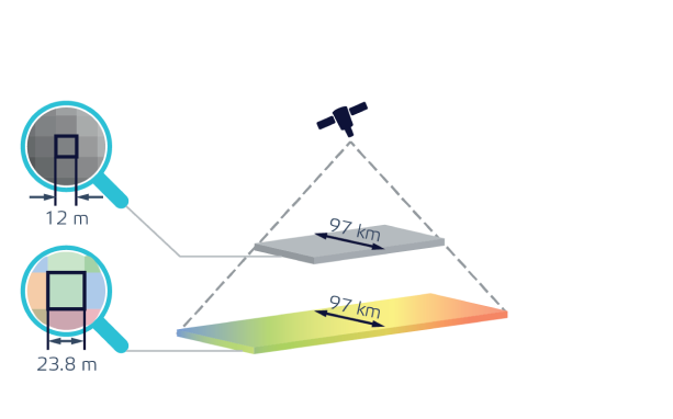
Spectral range
Terrain permit
Photo stripe width
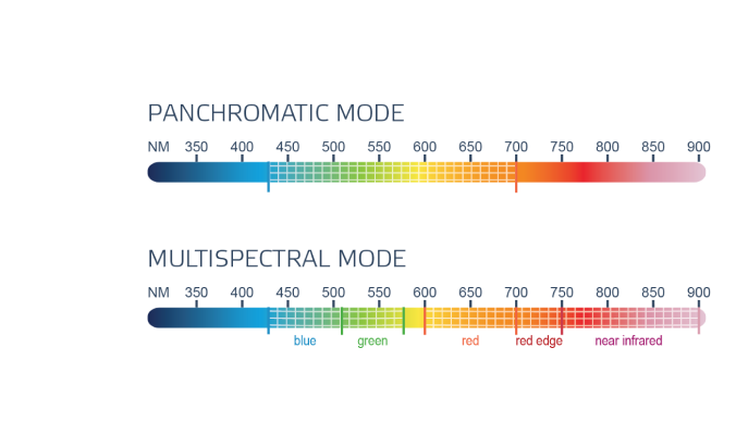
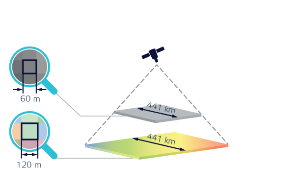
Spectral range
Terrain permit
Photo stripe width
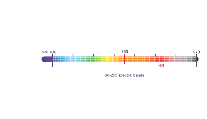
Spectral range
Terrain permit
Photo stripe width
Let's stay in touch
Give us a call
+7 495 745-59-57
Mail us
info@terratech.ru

Moscow, Russia
